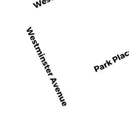
42 -44 WESTMINSTER AVE
Owner Information
PRESCOTT ENID ELAINE
35 GROVE ST
AUBURNDALE, MA 02466


Property Details
42 -44 WESTMINSTER AVE is classified as a Two-Family Residential (Ranch).
The primary structure on this property was built in 1970. There are 2,068ft2 of built area within this property. There is 2,068ft2 of residential/living space within this property. This property is listed as having 12 rooms. There are 2 units within this property.
42 -44 WESTMINSTER AVE is valued at $686,500. The land is valued at $420,100 and the structures are valued at $266,400.
This property is in Zone R1. Confirm with local Zoning Board authorities to ensure there are no overlays or other easements on this property.
The most recent deed for 42 -44 WESTMINSTER AVE is recorded at the local registrar in Book 49990, Page 546. 42 -44 WESTMINSTER AVE was last sold on Thursday, August 23, 2007 for $470,000.
Assessment data from fiscal year 2022.
Flood Data
According to the FEMA National Flood Hazard Layer, this property does not appear to be in a flood zone. It may also be in an area not yet reviewed. Nonetheless, confirm this information prior to taking any action.
To view the flood hazards around this property, create a FEMA "Firmette" Map of the area around 42 -44 WESTMINSTER AVE.
Broadband Internet Providers
| Provider | Type | Bandwidth (mbps) | |
|---|---|---|---|
| Comcast | Cable | 1000 | 35 |
| HughesNet | Satellite | 25 | 3 |
| GCI Communication Corp. | Satellite | 0 | 0 |
| Viasat Inc | Satellite | 100 | 3 |
| VSAT Systems, LLC. | Satellite | 2 | 1 |
| Verizon New England Inc. | Fiber | 940 | 880 |
| Verizon New England Inc. | DSL | 1 | 0 |
| RCN | Cable | 1000 | 20 |
| T-Mobile | Fixed Wireless | 25 | 3 |
| RCN | Cable | 500 | 20 |
Broadband service provider data from December 2020.
Adjacent Properties
- 40 WESTMINSTER AVE
Residential Condominium owned by GONDOUIN SYLVIE - 40 WESTMINSTER AVE
Residential Condominium owned by OLDENBURG BONNIE M - 46 WESTMINSTER AVE
Single Family Residential owned by JOHNSON PATRICK L - 141 LOWELL ST
Single Family Residential owned by LESTER WILLIAM - 137 LOWELL ST
Two-Family Residential owned by PICKTON MARK PAUL & FATMA N